- The Island's Memory Held in 123 Steps
- What Is Sabautsugaa? Let's Cover the Basics
- The Harsh History of an Island Not Blessed with Water
- I Actually Visited | What the 123 Steps Tell
- Things to Note Before Visiting
- Enjoy the Charm of the Sarahama District Too
- Tips for Photography at Sabautsugaa
- Handy Trivia to Know
- Frequently Asked Questions (FAQ)
- What Sabautsugaa Teaches Us
The Island's Memory Held in 123 Steps
To be honest, when I first learned of Sabautsugaa's existence, I thought, "a well? Is that interesting as a tourist spot?" Because I was more drawn to the so-called "photogenic" spots like 17END and Toguchi-no-Hama.
But actually visiting completely overturned that thinking.
Descending the 123 stone steps, feeling the sea breeze, gazing at the Miyako blue spreading before me — thinking that people drew water here for hundreds of years, my chest somehow grows hot. And when you hear that the women climbed these steep steps carrying water 3–4 round trips a day from 3 am, you're left lost for words.
I'll tell you in detail about Irabu Island's hidden landmark "Sabaokiido (Sabautsugaa)," interwoven with my own experience of actually visiting. If you're searching "Irabu Island sightseeing," this place's appeal will surely come across. It's not just the sea — it's a spot where you can feel Irabu Island's deep history.
What Is Sabautsugaa? Let's Cover the Basics
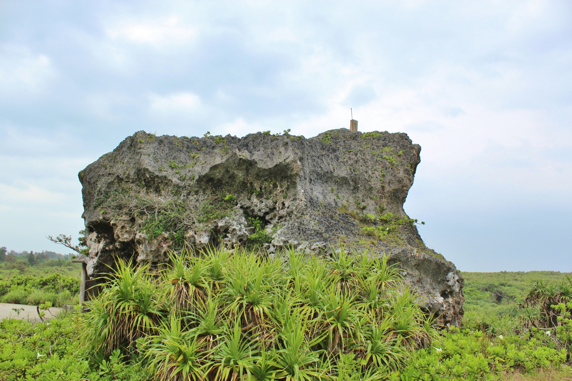
Sabautsugaa is a well standing quietly on the east side of Irabu Island, at the edge of the Sarahama district. "Gaa" means "well" in the Miyako dialect. In other words, it's "the well of Sabautsu."
As for why "Sabautsu," it's apparently because, seen from Ikema Island, this terrain resembles the mouth of a shark (saba). I wanted to check from Ikema Island with binoculars too, but honestly I couldn't quite confirm it… But just hearing the origin of this name conveys how closely people of the past observed nature.
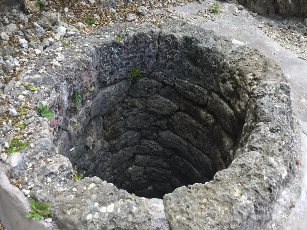
This well, a designated historic site of Miyakojima City, is about 1–1.5 metres in diameter and 4.5 metres deep. Until a simple water supply was set up in 1966, it was used as living water for the people of Sarahama for an astonishing 240 years or so.
The well was discovered by two young men, "Miyaagi-date no Kanedaishu" and "Fuzzuu no Matsudaishu." A legend remains that they found it by hearing the sound of water during a break from farm work on Sabautsubanta (the clifftop).
Access Information
Address: 588-70 Maezato, Irabu, Miyakojima City, Okinawa
Car park: Yes (about 5 cars)
Fee: Free
Time needed: About 30–40 minutes round trip (including climbing the steps)
Following the signs from the A-Coop in Sarahama is the easiest way. Partway the signs change to "Sabaokiido," so you might be momentarily anxious "huh, did I go wrong?", but it's the same place, so it's fine.
It's about 30 minutes by car from Miyako Airport, located about 15 minutes after crossing the Irabu Bridge.
The Harsh History of an Island Not Blessed with Water
The Miyako Islands, including Irabu Island, are islands made of uplifted coral reef. As a geological feature, rainwater easily soaks underground, and there are almost no rivers. In other words, it's an environment where securing water is incredibly hard.
This may be hard for us living in modern times to imagine. Because we've grown used to the ordinary life where water comes out when you turn a tap. But until just 60 years ago, on this island getting water was living itself.
Migrants from Ikema Island
The Sarahama district where Sabautsugaa is, is actually a settlement created by people who migrated from Ikema Island. In 1720, the population of Ikema Island grew too large and food shortages became serious, and the areas "Irabu Ikemasoe" and "Irabu Maezato" were created as branch villages.
Migrating to an unfamiliar land, the first thing they faced was the water problem. Sabautsugaa, which had been discovered by the people who originally lived on Irabu Island, was literally "the water of life" for the migrants.
The latest genome analysis has apparently also proven that Ikema Island and the Sarahama district are peoples with the same roots, which makes you feel the romance of history.
The Women's Harsh Daily Routine
When I read the text carved on the stone monument, my heart truly ached.
"Drawing water was the women's daily routine, and they made round trips up and down the 123 steps 3–4 times a day from 3 am — it has a harsh history of living."
3 am, you know. In pitch darkness, descending the steep stone steps and climbing back up carrying heavy water. And several round trips a day. I was wheezing after just going down and up once, but the women of the time repeated this every day.
And this well's water, with its salt concentration changing with the ebb and flow of the tide, was apparently not suited as drinking water. Even so, "just having water was a miracle," I suppose. Just having water to use for washing and cooking, how much it must have helped.
In households with many family members, the number of round trips increased too. There must have been mothers who carried water while carrying a child on their back. Just imagining it nearly brings tears.
I Actually Visited | What the 123 Steps Tell
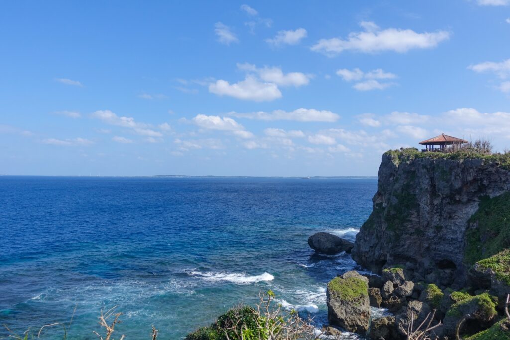
The first time I visited was a May afternoon. I parked the car at the car park, and the first thing that caught my eye was the explanatory stone monument and an ocean-view rest area. There's no roof, but sitting on the bench, the openness of surveying far into the distance was the best.
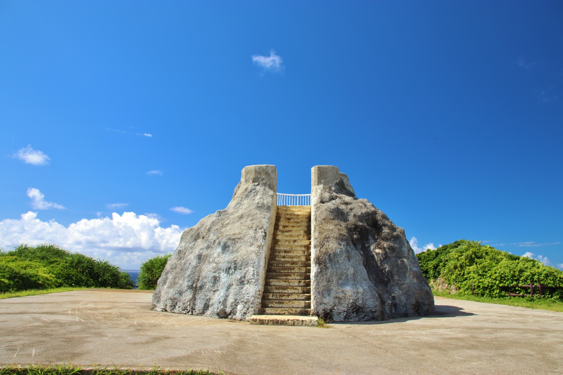
Proceeding beyond the monument, the steps descending alongside the rock come into view. These are the fabled 123 steps.
Mental Preparation Before Descending the Steps
To be honest, I underestimated it. I thought "just some steps, no problem." But actually starting to descend, it was steeper than I'd thought. And because the steps are made by carving the rock, the step heights are uneven, and there are many places with no handrail.
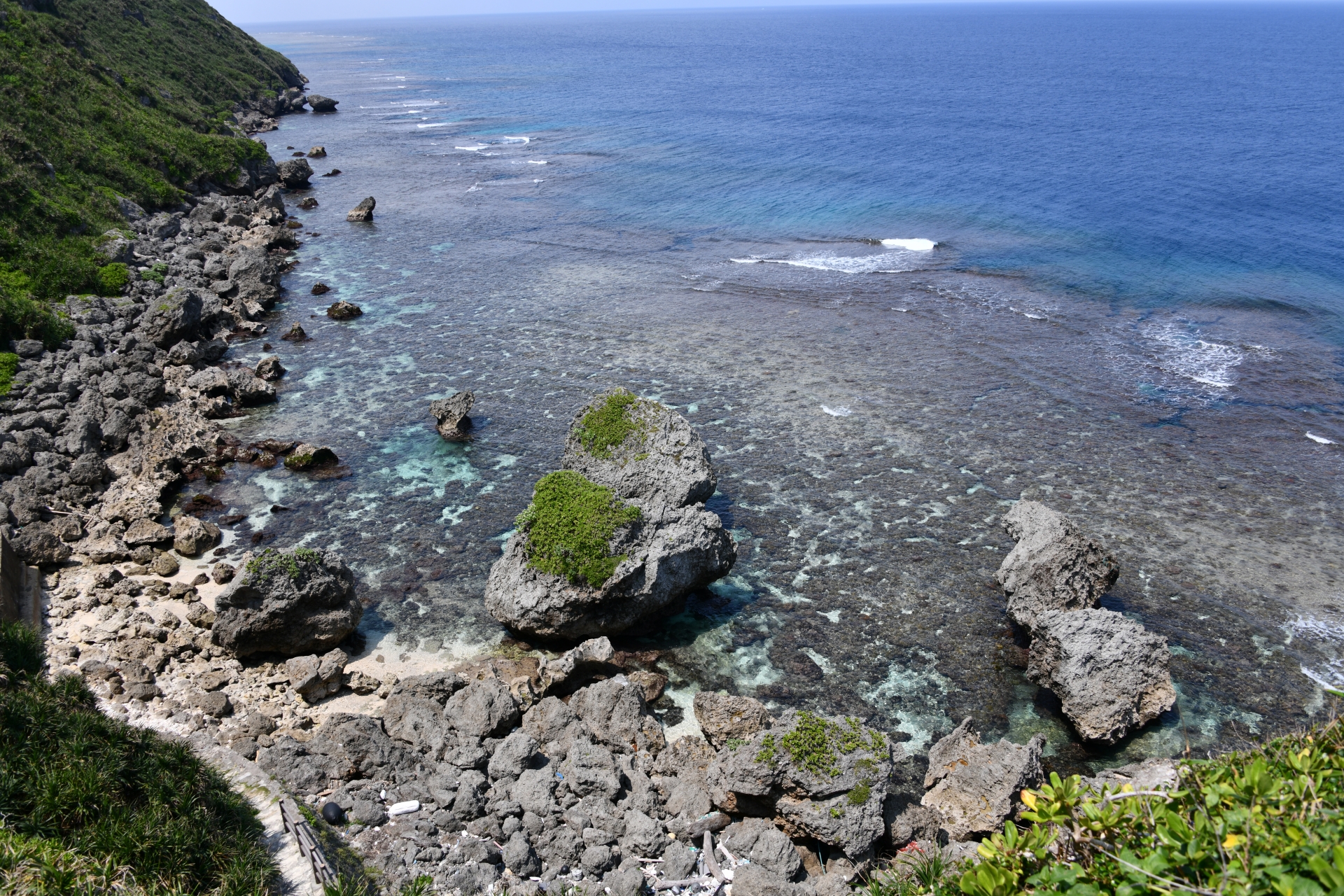
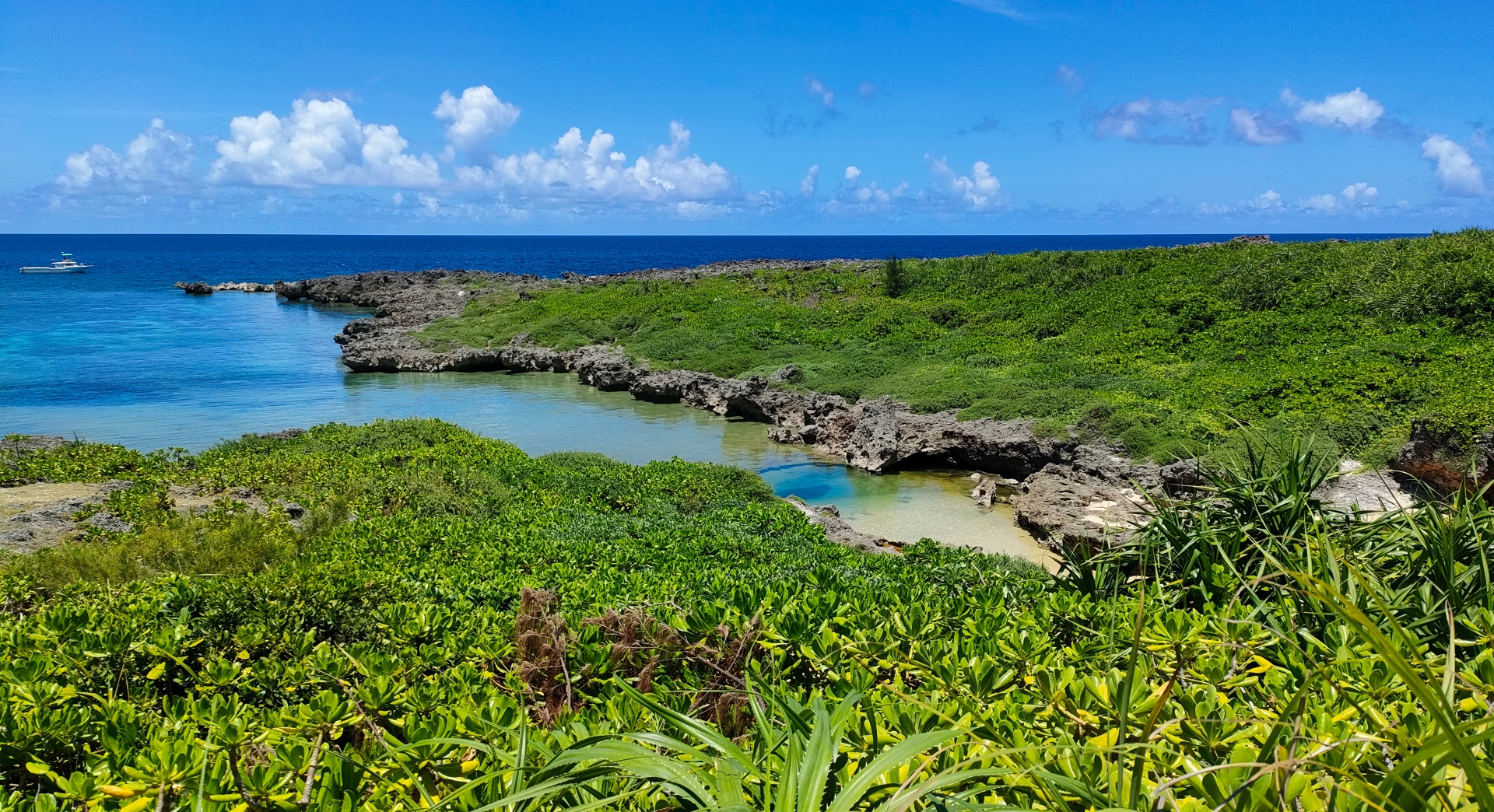
Stopping to rest several times along the way, I gazed at the sea spreading before me. Miyako blue is truly beautiful. The clarity is high, almost as if you could see to the bottom of the sea. The wind is strong, and the scent of the tide is thick.
Descending the steps, a thought suddenly came to me. "What kind of sensation was it to climb these carrying water?"
Arriving at the Well
Descending all 123 steps, there was a stone-built well. A little over 1 metre in diameter, 4.5 metres deep. It looks plain, but seeing this precise stonework conveys the high level of the stonemasonry of the time.
It's currently dried up, and is fixed with concrete to protect it as a historic site. I peered in, but there was only shallow water lying there. I'd imagined beautiful spring water, so I felt a little disappointed, but this is the reality.
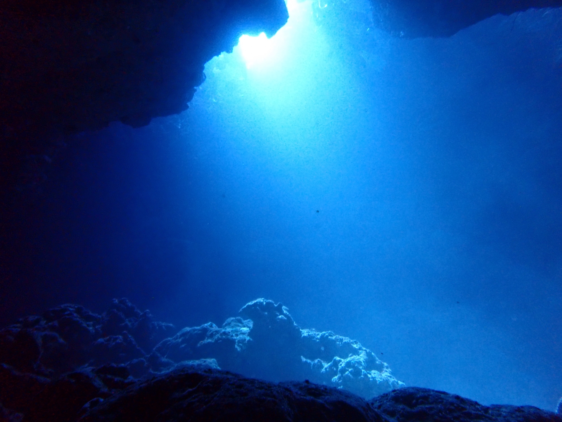
Right below the well is the sea. The sound of the waves can be heard up close, and the rocky area is rugged. There were people playing with snorkels, but when I asked a local, they said "this is a dangerous place." Beyond the reef where the white waves break, it suddenly gets deep, so you really need to be careful when swimming.
You can apparently swim to the Blue Cave, but I gave up since I'm not confident in my swimming. But just seeing the scenery was worth it enough.
The Climb Is Even Harder
Now, the problem is the way back.
The climb up is overwhelmingly harder than the descent. I ran out of breath partway and stopped many times. In temperatures near 30°C (86°F), climbing the steps while bathed in sunlight was harder than I'd imagined.
"People of the past were really too amazing…" I muttered in my heart many times as I climbed. And they did this 3–4 times a day. When modern me is wheezing after one round trip.
When I got back to the car park, I was already drenched in sweat. I slumped onto the bench in the rest area and couldn't move for a while. But somehow, there was a sense of accomplishment. I felt like I'd experienced, just a little, the hardship of the people of the time.
Things to Note Before Visiting
Sabautsugaa isn't developed as a tourist site, so there are a few things to note. Let me sum up what I thought "it's better to know this" from actually going.
Clothing and What to Bring
Essential items:
- Easy-to-walk-in trainers (sandals are a no)
- A hat
- Sunscreen
- Drinks (plenty)
- A towel
The steps have many unstable places carved from rock, so it's best to avoid beach sandals. I went in trainers, but even so there were several spots where the footing was unstable.
There's nothing at all to block the sun, so a hat and sunscreen are essential. Be especially careful in high summer. I went in May, but even so it was quite hot.
Bring plenty of water too. You sweat more than you'd think on the round trip of the steps. There's no vending machine nearby, so prepare in advance.
Suitable Times and Seasons to Visit
Recommended times:
- Early morning (6–8 am): cool and few tourists
- Evening (4–6 pm): the sun weakens and it's comfortable
It's safer to avoid the middle of the day. There's no shade, the stones of the steps get hot, and it's physically tough.
About the season:
Seasonally, the cool period of October–April is recommended. If you go in summer (June–September), aim for early morning or evening. During typhoon season (July–October) the waves can get high, so check the weather forecast first.
For Those Not Confident in Their Fitness
For those anxious about descending the steps, just the view from above is worth it enough. The scenery visible from the car park rest area is also wonderful, so enjoy it without forcing yourself.
When an acquaintance of mine took their mother, who has bad legs, they apparently had her wait at the rest area and descended the steps alone. Even so, the mother was delighted, saying "the scenery is beautiful, I'm glad I came."
Enjoy the Charm of the Sarahama District Too
If you're going to Sabautsugaa, since you're there, do stroll the Sarahama district too. This area has a distinctive atmosphere and is interesting.
Sarahama, the Bonito Town
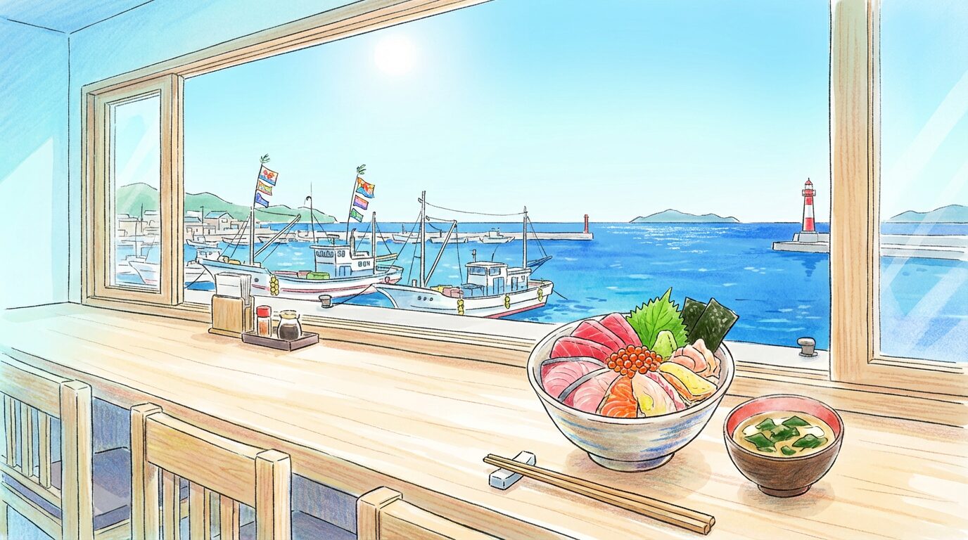
Sarahama is a port town famous for bonito fishing. I was surprised to hear that it accounts for 80% of Okinawa Prefecture's bonito catch. Large fishing boats line up at the port, and it's lively.
There are two eateries, Obanmai Shokudo and Uoichiba Ichiwa, where you can eat fresh bonito and tuna dishes. I had the bonito sashimi set meal at Obanmai Shokudo, and this was simply superb. There was no fishy smell at all, the flesh was springy, and it was a different thing from the bonito you eat in Tokyo.
In front of Obanmai Shokudo's entrance there's a mural that looks like bonito fishing, where you can take a social-media-worthy photo.

A Maze-Like Settlement
The settlement of Sarahama has houses packed tightly on a steep slope, with narrow alleys too tight for cars winding through it. Just like a maze.
This distinctive townscape is a remnant of a history where many people had to live on limited flat land. Walking through it, you get the sensation of having slipped back in time to the Showa era.
While strolling the alleys, a local grandmother called out to me "where are you from?", and taught me various things about the well's history. This kind of chance encounter is one of the real joys of travel, isn't it.
Nearby Sights
There are other highlights near Sabautsugaa too.
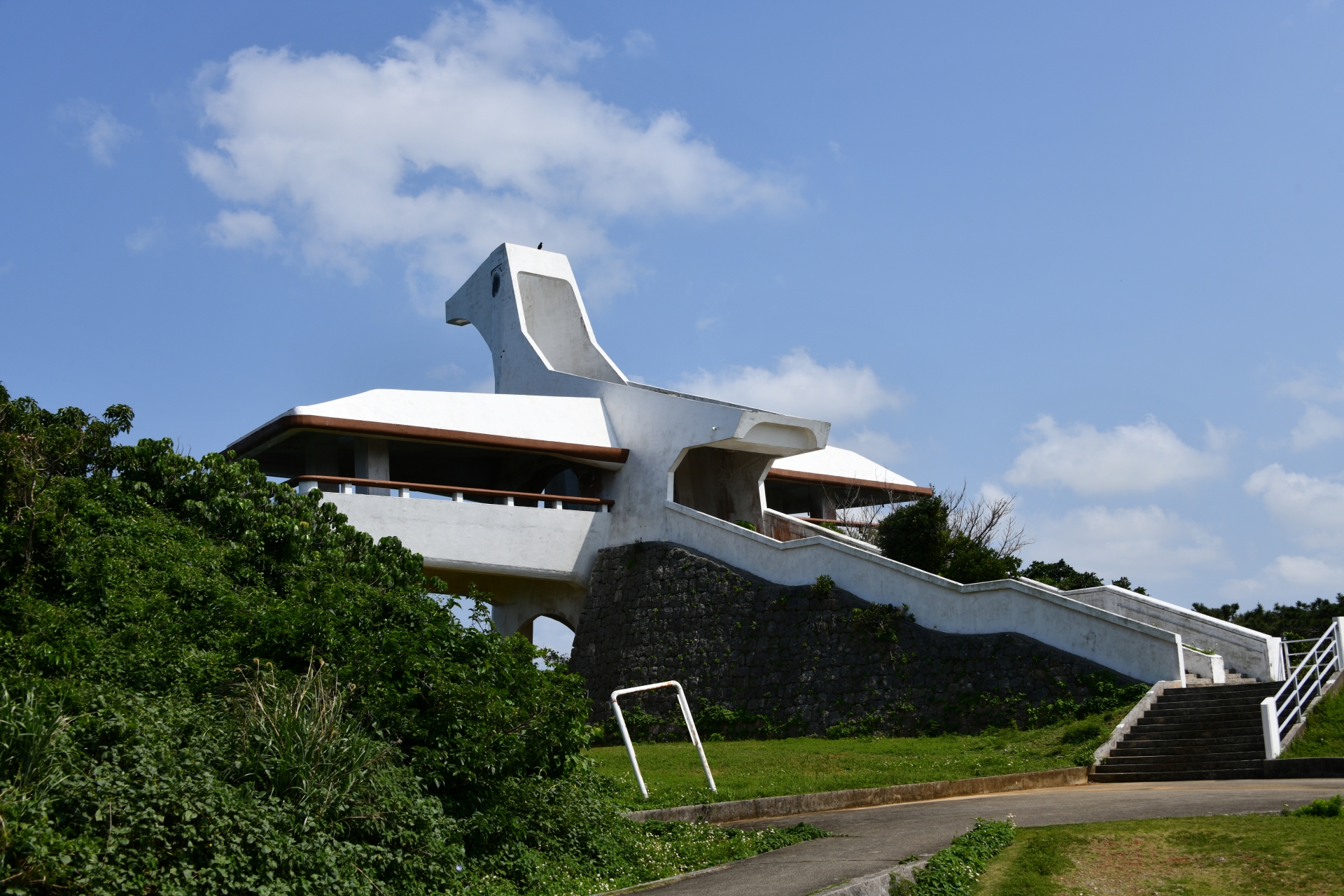
Makiyama Observatory: An observatory at the highest point on the island. Its appearance modelled on a sashiba (a kind of hawk) is distinctive. The view from here is the best. You can survey the Irabu Bridge, Miyako Island and as far as Ikema Island.
Funausagibanata: An observatory meaning "the cape that sees off boats." Unfortunately it's off-limits due to deterioration, but the view from the surrounding area is wonderful.
Shiratorizaki (Cape Shiratori): A cape with a view of Miyako Island's Nishi-Hennazaki and Ikema Island. It's developed as a park, where you can spend time at leisure.
My recommended course is the flow of Makiyama Observatory → Sabautsugaa → lunch in Sarahama → Shiratorizaki → Sawada-no-Hama. Half a day is plenty to go round.
Tips for Photography at Sabautsugaa
Since you're visiting, you want to keep good photos too, right. Let me share the points I thought "this was good!" from actually shooting.
Composition Ideas
The sea view from the steps: The sea photo taken from partway down the steps is the most photogenic. The contrast of blue sky and Miyako blue is beautiful. Shooting in portrait orientation also expresses the depth of the steps.
The well and sea as a set: Putting the well in the foreground with the sea in the background brings out an atmosphere where history and nature coexist.
Panorama from the rest area: A panorama shot taken from the car park rest area is also recommended. Using your phone's panorama mode, you can fit the vast sea into one shot.
Things to Note When Shooting
The steps are narrow and steep, so don't get too absorbed in shooting. Watch your footing, safety first.
A selfie stick is handy for taking photos from a high viewpoint. The sea colour looks more beautiful. However, on windy days take care not to have it blown away.
The sea colour changes by time of day, so visiting several times to capture different expressions might be interesting too. I went in the afternoon, but I think photos taken in the morning light would be beautiful too.
Handy Trivia to Know
The History of Miyako Island's Water Situation
Looking at Miyako Island as a whole too, water shortage was a serious problem in the past. The islanders lived relying on tanks that stored rainwater and on coastal spring water (gaa).
Until before the war, each settlement had several communal wells, and going to draw water there was a daily routine. The water supply was fully set up far later than on the mainland, from the 1960s onwards.
1966, when Sabautsugaa stopped being used, was right in the middle of Japan's period of high economic growth. The time when the Tokyo Olympics had ended, the Shinkansen had opened, and convenient life had become ordinary on the mainland. Until that time, on this island the drawing of water continued.
About the Word "Gaa"
"Gaa," meaning well in the Miyako dialect, is a word you see here and there on the island. It's become place names too, like "Imugaa" and "Nuugaa."
These wells were not merely water sources but also central places of the settlement. People who came to draw water exchanged information and chatted. They probably also served a role like what we'd now call a community space.
Sabautsugaa must surely have been such a place too. It was hard labour, but perhaps the women gathered, shared each other's hardships, and encouraged one another.
The High Level of Stonemasonry
Looking at Sabautsugaa's stonework, you're amazed by the high level of craftsmanship of the time. The stones, stacked without gaps, have supported the well without collapsing for hundreds of years.
In an age without concrete, building 123 steps on a steep slope and digging a well 4.5 metres deep. And right by the sea, in a place easily affected by the waves. How hard a construction this was, I can't even imagine.
Even with modern technology, making the same thing wouldn't be easy. I bow my head to the wisdom and skill of our forebears.
Frequently Asked Questions (FAQ)
Q1: Is it OK to swim?
Swimming is possible, but the locals say it's "a dangerous place." The rocky area is rugged and beyond the reef it suddenly gets deep, so sufficient care is needed.
If you snorkel:
- Always with two or more people
- Wear a life jacket
- Avoid days with high waves
- Check the high- and low-tide times
I hear you can swim to the Blue Cave, but it's for advanced swimmers. For beginners, I recommend not forcing it and enjoying the scenery.
Q2: Is it OK with children?
The steps are steep and unstable, so honestly I don't recommend it for those with small children. For children in the upper years of primary school or older and confident in their fitness I think it's fine, but an adult must always accompany them. Just viewing from the rest area is enjoyable enough, so there's no need to force the descent.
Q3: Wheelchairs or pushchairs?
Unfortunately, access by wheelchair or pushchair is difficult. From the car park to the rest area is flat, but the steps naturally can't be used.
Q4: Is there a toilet?
There's a pavilion and toilet near the car park (Sabaoki Park). However, it can't be said to be very clean, so I recommend using one beforehand.
Q5: How long does it take?
Just the round trip of the steps is about 30–40 minutes. If you take photos and enjoy the scenery, it's good to allow about an hour.
Q6: Can you go on a rainy day?
The steps become slippery, so it's safer to avoid rainy days. Even on fine days the stones can be damp, so watch your footing.
Q7: Summer or winter, which is recommended?
Personally I recommend winter (November–March). It's cool and comfortable, and there are fewer tourists. Summer is too hot and physically tough. However, in winter the north wind can get strong, so wind protection is needed.
Q8: Are there shops nearby?
There's nothing around Sabautsugaa. Go to the settlement of Sarahama and there's a supermarket (A-Coop) and eateries, but you need to travel about 10 minutes by car. Prepare drinks and light snacks in advance.
What Sabautsugaa Teaches Us
Sabautsugaa may be plain as a tourist spot. It's not a "photogenic" place like 17END or Toguchi-no-Hama, and it has no Instagram-worthy glamour.
But this place certainly has "something."
It's the proof of people having lived while facing nature. The weight of living in an age unconnected to convenience. The preciousness of a single drop of water. The sweat and tears of the women. The resolve to support a family.
How grateful a thing the "water" we take for granted is. How much the water that comes out when you turn a tap stands upon the effort of so many people.
I thought about such things as I climbed the steps of Sabautsugaa.
If you visit Irabu Island, do make your way to this place once. You're sure to be able to touch something deeper, different from the beauty of the sea. By knowing history, travel becomes richer. That's what I believe. 123 steps. 240 years of history. The women's daily routine. The story this small well tells is by no means small.
Facility Information Summary
| Item | Details |
|---|---|
| Name | Sabaokiido (Sabautsugaa) |
| Address | 588-70 Maezato, Irabu, Miyakojima City, Okinawa |
| Access | About 30 minutes by car from Miyako Airport, 5 minutes by car from the A-Coop in Sarahama |
| Car park | Yes (free, about 5 cars) |
| Fee | Free |
| Time needed | 30 minutes–1 hour |
| Steps | 123 steps (one way) |
| Designation | Miyakojima City designated historic site |
How about adding Sabautsugaa to making wonderful memories on Irabu Island? It's sure to become an unforgettable experience.