When I first landed at Shimojishima Airport, the moment I came off the runway I was a little bewildered. Everywhere you look it's flat, the trees are low, and the sky is absurdly wide. Even though it should be connected to Irabu Island by a bridge, the island's outline is so unclear that my memory of whether I'd even crossed over was hazy. "Wait, where am I?" I thought.
That was my first encounter with Shimojishima.
Area 9.68 square kilometres. Highest elevation 21.6 metres. Rivers: zero. On a map it's a surprisingly thin, flat island, and compared with neighbouring Irabu Island it has no presence. In tourist guides it's often introduced as "the island with Shimojishima Airport," and there aren't many occasions when the island's own history is told.
But in reality, this small island holds records spanning over 500 years. Documents recorded by a drifting Korean ship, traces of villages from the Old Ryukyu era, the scars of the great tsunami that swallowed the whole island in 1771, an airport that kept training pilots for over 40 years. Contrary to the monotony of the terrain, the accumulated time is thick.
In this article, I'll write about Shimojishima's history from the formation of its terrain to the present, weaving in my experience of walking the place. The question I had gazing at Toriike Pond — "why is there a hole like this here?" — and the wonder I felt watching planes from the airport car park — "why did a training airport become a tourist spot?" — gradually come into answer by tracing the history.
Reading history articles, haven't you ever felt "this is hard and I don't really get it"? Just years and events lined up, with no connection anywhere to your own life. I want to write this article so it doesn't become that. When you cross the Irabu Bridge into Shimojishima, when you stop in front of Obi-iwa, when you stand on the sands of 17END — knowing how that place came to be there changes your distance from the scenery. That's what I'm aiming for.
Shimojishima also has a place called "35END" where you can watch planes take off and land. It's the point at the southern end of the runway, and the impact of an airliner passing right in front of you is different again from 17END. The numbers in the place name come from the runway's azimuth, and the way the pilots refer to it took hold as the place name itself. The very place name "35END" still carries on the history of this island walking the path of a training airport. An island's name and place names sometimes have the history of that place carved into them.
- Shimojishima's Formation and Terrain | A Flat Island Created by an Uplifted Coral Reef
- Shimojishima in Old Records | 1463, "Shimakojima" in the Annals of the Joseon Dynasty
- A Village of the Old Ryukyu Era | Traces of Kidomari Village
- The Opening of Pastureland | In the Early Modern Period, Shimojishima Was Grazing Land for Cattle and Horses
- The Sawada Bridge and the Great Meiwa Tsunami | 1771, the Natural Disaster That Struck the Island
- Modern Transport Infrastructure | The Six Bridges Connecting Shimojishima and Irabu Island
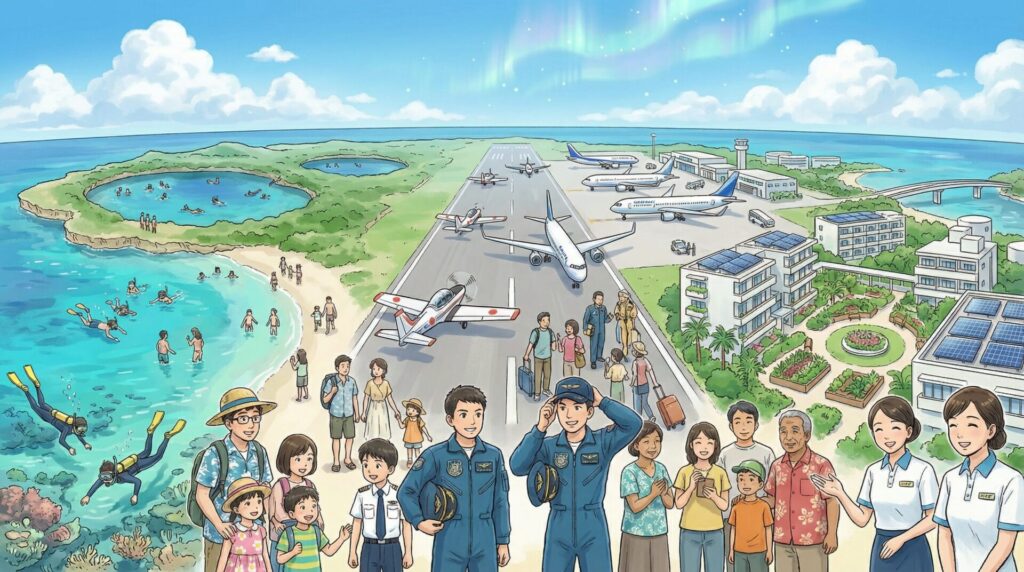
- The Opening of Shimojishima Airport | 1979, an Island of Pilot Training
- The Passenger Conversion of Shimojishima Airport | 2019, Evolution into a Tourism Island
- The Transition of Administration | From Irabu Town to Miyakojima City
- Shimojishima Now, and from Here
Shimojishima's Formation and Terrain | A Flat Island Created by an Uplifted Coral Reef
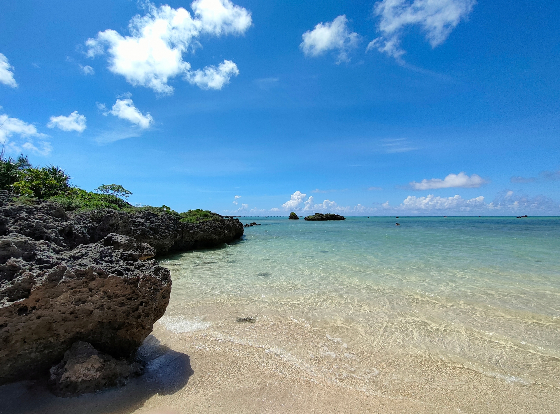
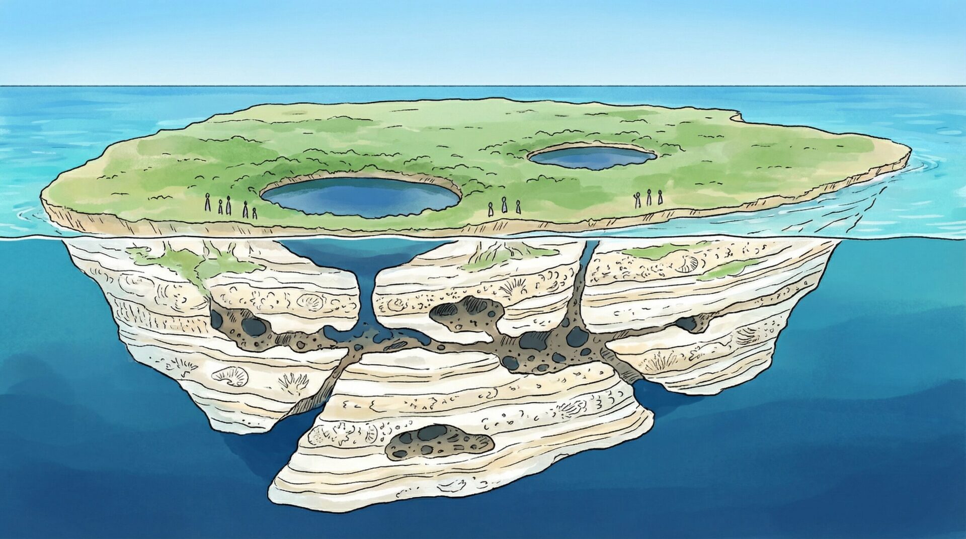
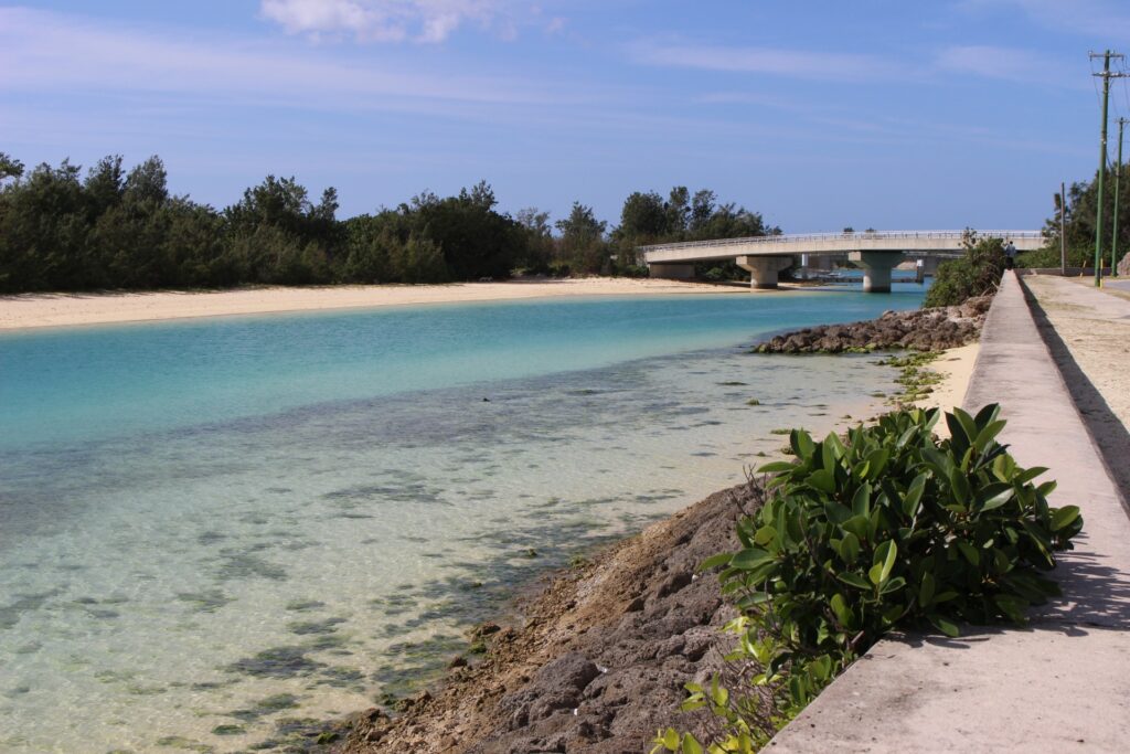
Walking the island, the ground underfoot is oddly white. Not sand, not soil — there are many places where rough, whitish rock shows its face on the ground. This is Ryukyu limestone. The whole island is covered with this porous rock.
Shimojishima is an island made of an uplifted coral reef. Long ago, a coral reef that was on the seabed was pushed up by crustal movement and appeared as land. Even after uplift, over a long span of years rainwater and seawater kept dissolving the limestone, creating countless cavities and passages beneath the surface. The result is the mysterious terrain dotted about the island.
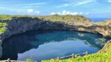
Toriike Pond is, I think, the prime example. Two holes connected to the sea open in the island's interior, and the water surface is deep and blue. It's famous as a spot tourists visit to take photos, but those holes were formed when the ceiling of a cave made by the dissolution of the coral reef collapsed. Seeing it after knowing the terrain, the sense of "this was once a cave" becomes real. The blueness of the seemingly bottomless water, and the fact that its bottom connects to the sea, take on different meaning when seen with knowledge of how the terrain formed.
The flat terrain has no rivers. Even when it rains, the water soaks straight into the porous limestone. The water vanishes before it flows over the surface enough to form a river, so the whole island is endlessly low and endlessly whitish in scenery. Both fields and roads are land where, dig a little, white rock comes out.
A highest elevation of 21.6 metres is strikingly low even among Okinawa's islands. In typhoon season the waves sometimes go over the island, and from of old the sea was both a blessing and a threat to the residents. That fear became reality in the great tsunami of 1771, but I'll write about that later.
As a feature of the terrain, one more thing not to forget is that "the island is hard to see." With no high mountains and no protruding terrain, when approaching by ship from afar it's hard to notice the island's existence. For navigators of old, this low island was both a danger of collision and a hidden place of refuge. The lowness of this terrain may also be related to the background of why the Miyako islands were recorded in foreign documents as "mysterious islands beside the sea route."
You could say the island's terrain itself is the lead character of its history. How people lived, the form of agriculture, how the transport infrastructure was built — all of it began from the condition of this "flat, low, riverless island made of porous limestone." Without first knowing this terrain, much of what has happened on Shimojishima is hard to understand.
Shimojishima in Old Records | 1463, "Shimakojima" in the Annals of the Joseon Dynasty
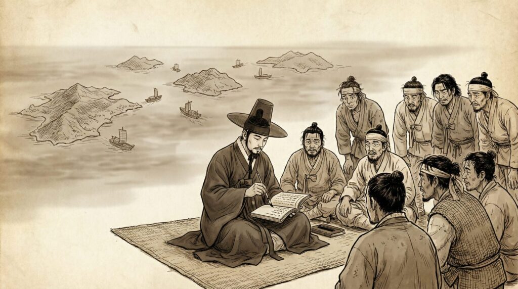
The oldest record in which Shimojishima's name appears in documents is said to be the Annals of the Joseon Dynasty of 1463. When a Korean ship drifted into the Miyako waters, the exchanges with the islanders were recorded in detail, and among them appears the name "Shimakojima." Researchers see this "Shimakojima" as referring to Shimojishima.
That this small island's name remains in a foreign record from over 500 years ago is, when you think about it, a curious thing. For the drifting Korean sailors, the Miyako waters were a life-or-death place. Which island they approached, which islanders they exchanged words with, what food they received. Such detailed exchanges were recorded because there was an obligation to make a detailed report after returning home, and it's preserved in a readable state even now, 500 years later.
Events that didn't remain in the Japanese records were carved into the Korean records across the sea. History is like that — what remains changes by who wrote it and for what purpose. A drift report that a Joseon Dynasty scribe recorded as part of his duties came to illuminate the history of a remote Okinawan island.
You can tell that Shimojishima at the time was already inhabited, or at least that people came and went regularly. Irabu Island and Shimojishima are geographically one, and strictly distinguishing "which island's resident" a person of the two islands was may not have meant much. They must have caught fish together in the Miyako sea and weathered typhoons together.
Because of this record, you can say "at least by 1463, Shimojishima functioned as an inhabited island." What it was like before that, there's no clear record for now. When a limestone island sunk on the seabed uplifted into land, and when the first humans set foot on it. That answer is still unknown.
However, it's certain that the Miyako islands were on the East Asian sea routes and had contact with the outside from an early stage. In an era when multiple powers — China, Ryukyu, Japan and Korea — came and went across the sea, the Miyako islanders provided food to drifting ships and sometimes exchanged information. Shimojishima must have been part of that arena of exchange, and I think it's more natural to assume there was far more contact, just not left in documents.
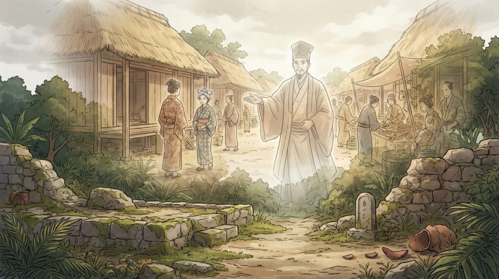
A Village of the Old Ryukyu Era | Traces of Kidomari Village
In the Old Ryukyu era, it's known that there was a settlement called "Kidomari village" in the area of Shimojishima toward Irabu Island. The exact location is said to be around the present Sawada district, but even going to the site there are almost no visible traces. No stone monument, no remains of buildings, and even whether it remains as a place name is uncertain in part.
There's a theory that the word "Kidomari" means "a place where boats moor," that is, a port where ships dock. On flat Shimojishima, people gathered where there was terrain a ship could safely approach, and a settlement formed. In an era when living with the sea was a given, terrain where a ship could dock was valuable above all.
In Old Ryukyu era administration, the Miyako islands were managed under a division called "magiri." Shimojishima belonged to the same administrative unit as Irabu Island, and wasn't treated as an independent administrative district. Rather than an island, the image is closer to being managed as part of Irabu Island. Miyako at the time was under the rule of the Ryukyu Kingdom, with a system of officials dispatched from Miyako Island to each island. There was also an obligation to pay tribute in products like rice and millet, and remote-island life continued in the form of scraping by on agriculture and fishing while paying part of it up.
When Kidomari village disappeared, and why it was integrated with other settlements, isn't clearly known. It's a matter of an era with few records, and the details are still under research. In 2013 a research report called "Survey Results of the Irabu-Shimojishima Kidomari Village Site" was published, but many mysteries remain. An accumulation of life not left in records changed the shape of the settlement at some point. Whether it spanned many generations is, by now, hard to trace.
Among the small shrines and prayer sites remaining on the island, some may hold the memory of that era somewhere. Asking the island's old folk, the story "long ago people gathered around here" sometimes comes up. History not left in records sometimes remains as memory.
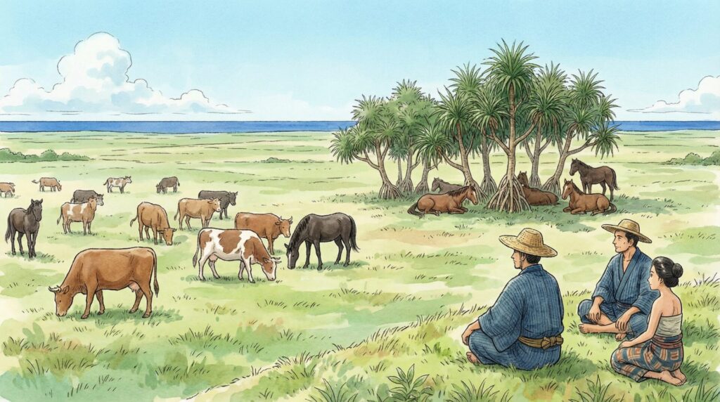
The Opening of Pastureland | In the Early Modern Period, Shimojishima Was Grazing Land for Cattle and Horses
Entering the early modern period, Shimojishima came to be used as an island for raising cattle and horses. The flat terrain and wide grassland were suited to grazing livestock. A record remains that in 1767 (Ryukyu Kingdom era), an instruction was issued to plant trees on the island to maintain the pasture. Protecting the pasture was that important a task.
In the Miyako and Yaeyama of the time, livestock were indispensable for both agriculture and transport. Without water buffalo and horses, it was hard to till the fields or carry goods. By setting up a dedicated pasture on Shimojishima, it played a role in maintaining the agricultural base of Miyako as a whole, and you can tell it was used deliberately as "functioning land," not a "remote island with nothing."
To manage a pasture required not only maintaining the grassland but securing water too. On riverless Shimojishima, they likely secured water for the livestock to drink by building facilities to store rainwater or digging wells. The limestone bedrock drains too well, so water tends to vanish underground. The difficulty of water management is a challenge in modern agriculture too, and you realise anew it's a problem that has continued since ancient times.
Land that was used as pasture later becomes an airport. Wide, flat land needed for a runway is also suited to pasture. The uses are completely different, but the condition of "spaciousness and flatness" was a consistent value of the land called Shimojishima. The era changes what's placed on it, but the characteristics the land holds don't change. That the island's terrain has, after hundreds of years, kept being used for different purposes is, I think, interesting.
This pasture would suffer major damage in the 1771 tsunami. The livestock drowned, the grassland was flooded, and the grazing land raised over many years was destroyed in a single night. Before and after the tsunami, the island's industrial structure must have had no choice but to change. That story continues in the next section.
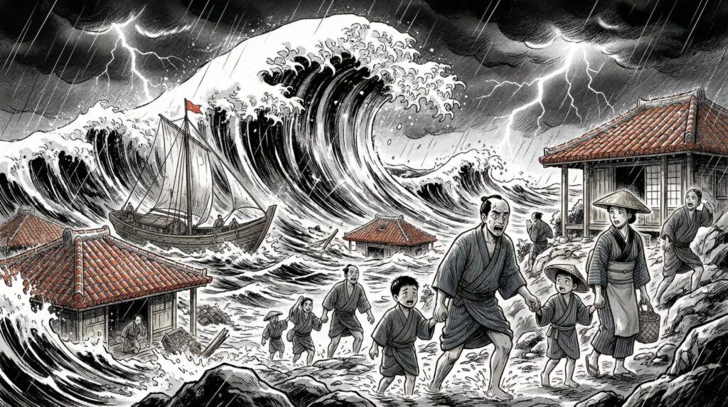
The Sawada Bridge and the Great Meiwa Tsunami | 1771, the Natural Disaster That Struck the Island
10 March 1771 (lunar calendar). This date is unavoidable in telling the history of Miyako and Yaeyama. A magnitude 8.0 earthquake occurred with its epicentre on the seabed south of the Yaeyama Islands, and the tsunami that surged afterwards catastrophically destroyed the islands of Miyako and Yaeyama, beginning with Ishigaki Island. It's the event called the "Great Meiwa Tsunami."
A huge wave surged onto Shimojishima too. The records say a wave of about 13 jō (roughly 40 metres) washed in. Considering the island's highest elevation is 21.6 metres, the whole island was completely submerged. There was nowhere to flee. The pasture was submerged, and both cattle and horses drowned. The "Sawada Bridge," which connected Irabu Island and Shimojishima at the time, was also damaged by this tsunami.
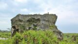
A huge rock called Obi-iwa (Belt Rock) lies on the west coast of Shimojishima. It's an absurdly large rock — about 26 metres long, and several metres in both width and height. This is said to have been thrown up from the sea by the Great Meiwa Tsunami. I once went to see it, but my sense couldn't catch up to "did this move by a wave?" against the rock's size. It's that big. How much force has to act for that rock to be carried from sea to land? Even told in numbers, my imagination can't follow.
A tsunami boulder is terrain that conveys evidence of a past tsunami to the present. That after hundreds of years that rock still remains on the island's shore means it keeps telling the humans who see it "what happened back then." Historical records aren't only writing. Terrain itself can become a record.
After the Great Meiwa Tsunami, the islands of Miyako and Yaeyama, whose populations plummeted, took many years to recover. Shimojishima's pasture probably didn't return right away either. Many people must have changed how they related to the sea at the boundary of the tsunami.
Many people who visit this island now take a photo in front of Obi-iwa and pass by. But knowing the reason that rock is there changes the meaning of the scenery. What happened here 250 years ago — its trace still remains on the shore now.
Modern Transport Infrastructure | The Six Bridges Connecting Shimojishima and Irabu Island
Between Shimojishima and Irabu Island there are now six bridges. The two islands are surprisingly close on a map, and there are places separated only by a narrow channel. Even so, without bridges you could only cross by boat, and an era of inconvenient daily comings and goings continued.
The oldest bridge is the Kuninaka Bridge, built in 1912. Next, the Nakachi Bridge followed in 1919. The early 20th century was an era when Okinawa was still part of the Empire of Japan, when administrative infrastructure development was advancing in various places. Even on remote islands, a movement to build bridges and connect island to island had begun.
Before the bridges, the only way to go back and forth between Shimojishima and Irabu Island was to cross by small boat. Timing it to low tide, you'd put a boat loaded with goods out onto the channel. On bad-weather days you couldn't cross. If the school was on Irabu Island, the children of Shimojishima must have crossed to attend every morning. The bridges resolved such inconveniences of life, one by one.
The number six shows there are multiple channels between the two islands. The time and purpose each bridge was built differs slightly. To carry agricultural goods, to secure a school commute route, to connect fishing bases. Each bridge had the need of the people of the time. The last one was built after entering the 1960s, taking over half a century until the bridge development was complete.
Driving, you cross the six bridges almost without noticing. But stop a little on a bridge and look down at the channel, and the realisation that they used to come and go by boat hits you. In the era without bridges, this channel was an uncrossable boundary. How much building bridges changed daily life has a part you can't grasp from numbers. The view from atop a bridge is quiet, the water surface glittering as it catches the light. It's not a tourist attraction, but standing here you feel the time of history, island connecting to island.
Since the airport was completed, Shimojishima has come to function ever more as one with Irabu Island. Only with the bridge network can Shimojishima Airport be used as the access hub for all of Irabu Island.
The Opening of Shimojishima Airport | 1979, an Island of Pilot Training
In 1966, Japan's Civil Aviation Council issued a recommendation. To respond to the era of mass transport by jet airliners, an airfield dedicated to pilot training should be developed urgently. Jets are fast, heavy, and difficult to take off and land. It was judged that to train large numbers of skilled pilots, a dedicated training facility was needed.
Training at Naha Airport would get in the way of actual passenger flights. Honshu's airports were also congested and hard to use for training. So a place was sought with a small population, no housing around it, and room to lay a wide runway. A survey of candidate sites was conducted in 1968, and Shimojishima emerged as a strong candidate. There was wide, flat land, stable weather conditions, and few obstacles around. As a location for pilot training, the conditions were almost all in place.
In July 1979, Shimojishima Airport officially opened. A start as Japan's only airport dedicated to pilot training.
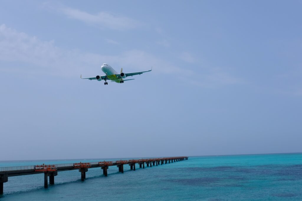
Have you heard the term touch-and-go training? It's training where the moment you land on the runway, you don't stop but gun the engine and take off again. Watching from outside the airport, the plane looks like it keeps repeating landing and take-off, and at first I thought "is that plane having some trouble?" That's not it — I learned later that's the correct way to train. By flying the same course many times, you imprint the feel of landing into your body.
One reason Shimojishima was chosen is the stability of Miyako's weather. Except for typhoon season, there are many clear days through the year on which flight training can be done. Fog rarely forms, and there are many days with good visibility. That the weather conditions suit training was, by itself, a great value. While at Honshu's airports training is often interrupted waiting for weather, at Shimojishima you can efficiently rack up training time. That merit is part of why this airport kept being chosen for 40 years.
Many airlines — All Nippon Airways, Japan Airlines, and later Vanilla Air — trained pilots here. Pilots who trained at Shimojishima Airport are still flying the skies across Japan. Thinking that, I feel something special. That this airport, which looks unconnected to tourists, has actually long supported Japan's aviation.
Gazing at the planes across the runway from the car park, I feel its weight — its depth of history — comes through a little.
The Passenger Conversion of Shimojishima Airport | 2019, Evolution into a Tourism Island
For a long time, Shimojishima Airport was a place unconnected to ordinary travellers. Training-only, with no passenger flights. With no flight you could buy a ticket and board, you couldn't use the airport for tourism. That situation continued for nearly 40 years.
Entering the 2010s, signs of change appeared. Tourists to Miyako Island were increasing, and demand for access was rising. There was also the problem that the operating rate was low against the facility scale to keep using it as a training-only airport. A discussion of whether passenger flights could be flown began to move.
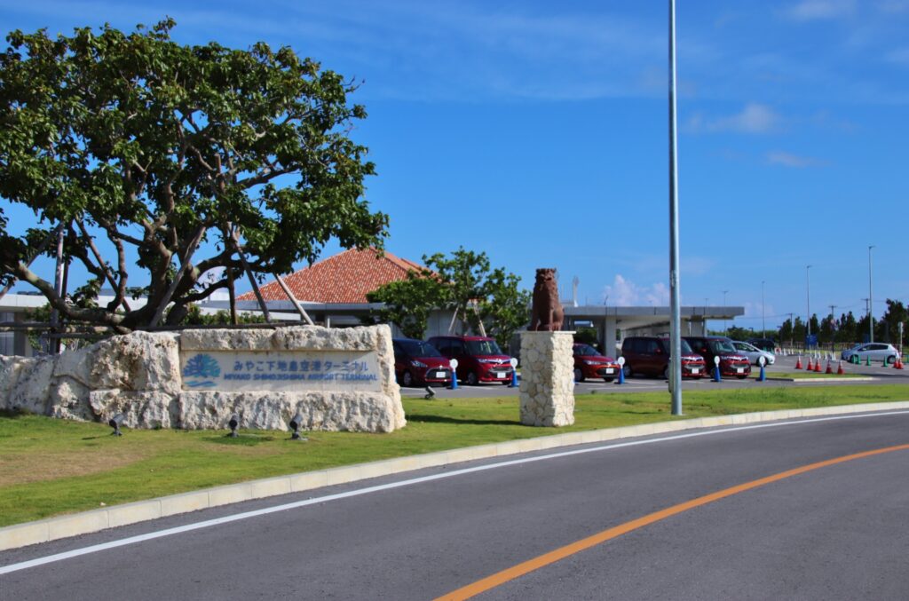
On 30 March 2019, the Miyako Shimojishima Airport Terminal opened, and Jetstar's first flight landed. I've seen photos of that day — a simple, tasteful terminal with a tourist-spot atmosphere. An open space, a different thing from the ruggedness of a training airport. It's quite different from the "training island" image.
What changed with the passenger conversion is that the arrival points to the Miyako area increased. Travellers who previously had to go via Naha or land at Miyako Airport could now enter the Irabu Island and Shimojishima area directly from Shimojishima. The travel distance to hotels and sightseeing spots shortened, and you can taste the remote-island mood right after arrival.
On the other hand, touch-and-go training didn't disappear entirely. It became an airport used for both passenger flights and training. Watching the sky from the car park, airliners and training planes sometimes appear alternately. Using the same runway, flying for different purposes. That gap is, I think, Shimojishima Airport's unique character.
Right after the passenger conversion the COVID crisis came, and there was a period when flight numbers plummeted. Even so, the airport didn't stop. From 2022 onwards, as travel demand recovered the flight numbers returned too, and it's now established as one of the gateways for Miyako Island travel.

The Transition of Administration | From Irabu Town to Miyakojima City
Administratively, Shimojishima has always been treated as a set with Irabu Island. It has never acted as an independent administrative district, at least since the modern era.
In the Ryukyu Kingdom era it was placed under Miyako's magiri system, and under the rule of the Satsuma domain the same framework continued. In the Meiji era it became part of Okinawa Prefecture, and eventually the administrative district was organised as Irabu Village. Irabu Village was later promoted to Irabu Town, and Shimojishima was managed as part of it.
In the Irabu Village and Irabu Town era after Meiji, the town office was placed on the Irabu Island side. When a Shimojishima resident did some administrative procedure, they had to cross the bridge and go to the office. Before the bridges were developed, that alone could be a half-day's work. The structure of the administrative window being "across the bridge" hasn't changed even now.
On 1 October 2005, Irabu Town merged with Hirara City, Gusukube Town, Shimoji Town and Ueno Village, and Miyakojima City was born. With this merger, the name "Irabu Town" disappeared from Shimojishima's address. It's now the address "Irabu, Miyakojima City, Okinawa."
When the merger was decided, I hear there were various opinions on the island. A concern that becoming part of a big city would make the administrative-service window more distant, and on the other hand an expectation that the financial base would stabilise and public works advance. It's a common debate in remote-island mergers. How daily life changed before and after the merger is hard to measure in numbers. I've also heard that once the merger was over, the voices of "glad we did it" grew more numerous.
In the 20 years since becoming Miyakojima City, major changes have continued in the Irabu Island and Shimojishima area. In 2015 the Irabu Bridge opened, dramatically improving access from Miyako Island. In 2019 Shimojishima Airport was converted to passenger use. You can't deny that becoming part of a big city through the merger accelerated this infrastructure development. The administrative form changing was directly linked to changing the island's physical shape.
The opening of the Irabu Bridge had a major indirect impact on Shimojishima too. You could now cross to Irabu Island by car from Miyako Island, and easily come on along the bridges to Shimojishima. Previously you could only cross by ferry, so travel took time and cost. After the bridge opened, not only did the number of tourists increase, but the cost of transporting goods from off-island also fell, and merits emerged in daily life too. The administrative merger and the transport-infrastructure development look separate, but only with both in place did both "livability" and "ease of visiting" improve.
For those who live there, the everyday sense of life probably matters more than administrative divisions. But between "when it was Irabu Town" and "since becoming Miyakojima City," there are parts where how the island looks changed, from outside and from within.
Shimojishima Now, and from Here
If I express Shimojishima today in a word, I think it's "an island in the midst of change."
Agriculture centres on sugarcane. The island's fields see harvests continue every year, and at harvest time that flat island fills with the green of sugarcane. Depending on when you visit, you can meet a scenery of sugarcane as far as the eye can see. It's plain, but that spread of green is, I think, one of the island's island-like qualities. Before the cut from winter into spring, sugarcane taller than head height grows like a wall along the roads, and walking the island your sense of direction goes a little awry. That's a fun experience in its own way.
The population isn't large, but because it functions as one with Irabu Island, the daily living infrastructure is in place. Supermarkets and convenience stores are on the Irabu Island side, right across the bridge. Since a life completed on Shimojishima alone is hard, the boundary between "Shimojishima life" and "Irabu Island life" is vague, and residents live going back and forth between both.
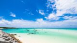
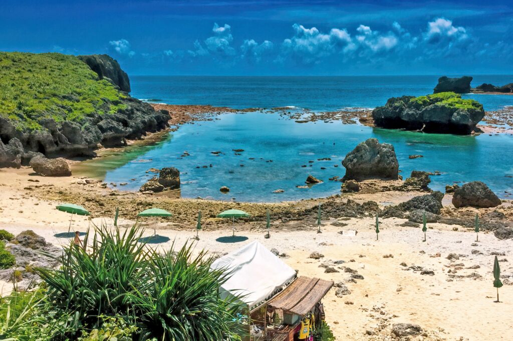
In terms of tourism, its presence has changed greatly these past few years. The opening of Miyako Shimojishima Airport was the direct catalyst, hotels increased around the airport, and visitors to 17END surged. 17END is the area at the northern end of the runway, a place that became famous all at once when the combination of the emerald-green shallows that appear at low tide and the planes passing right overhead spread on social media.
Increasing tourists is a plus for the island's economy. On the other hand, some people have complicated feelings about crowds rushing to the once-quiet sands. It's something happening at any tourist spot, but on a small, delicate island like Shimojishima, that balance is hard. Time bands when the car park fills up, the rubbish problem, the impact on the sea of crowds gathering at low tide. Both the benefit and the burden of becoming a tourist spot exist as reality.
What makes people who come to Shimojishima think "I want to come again" isn't only the beauty of the scenery, I think. The stillness of having nothing, the mysterious scenery of plane and sea overlapping, the sandbar that appears only at low tide. Protecting that also leads to long-lasting value as a tourist spot. The islanders understand that, and that's exactly why there are scenes where they agonise over how to pace the development. I know it's not a problem that gets an answer, but the very fact that such a debate continues also means the island is alive.
Toriike Pond, Obi-iwa, 17END. When you tour these spots, knowing how the terrain was born, where the rock came from, and around when this beach became famous changes how the scenery looks. From a "pretty photo spot" it becomes "a place within the time this island has walked." That, I think, is the meaning of knowing history.
There's still much about Shimojishima that hasn't been clarified. The exact location of Kidomari village, the post-tsunami recovery process, records of life before the bridges were developed — there are only fragments. Because there are things you don't know, you feel like seeing the island from a slightly different perspective when you come again. It's a small island, but not the kind you see once and understand entirely. The places that catch your eye change each time you come. That's, personally, what I like about Shimojishima. History doesn't give all the answers, but the fun of walking the island holding clues is something I feel every time I come here.
The Miyako Island Tourism Association sends out the latest tourism information for the Miyako area, including Shimojishima. Do use it as a reference for your travel plans.